Toronto Fire Insurance Atlases & Plans

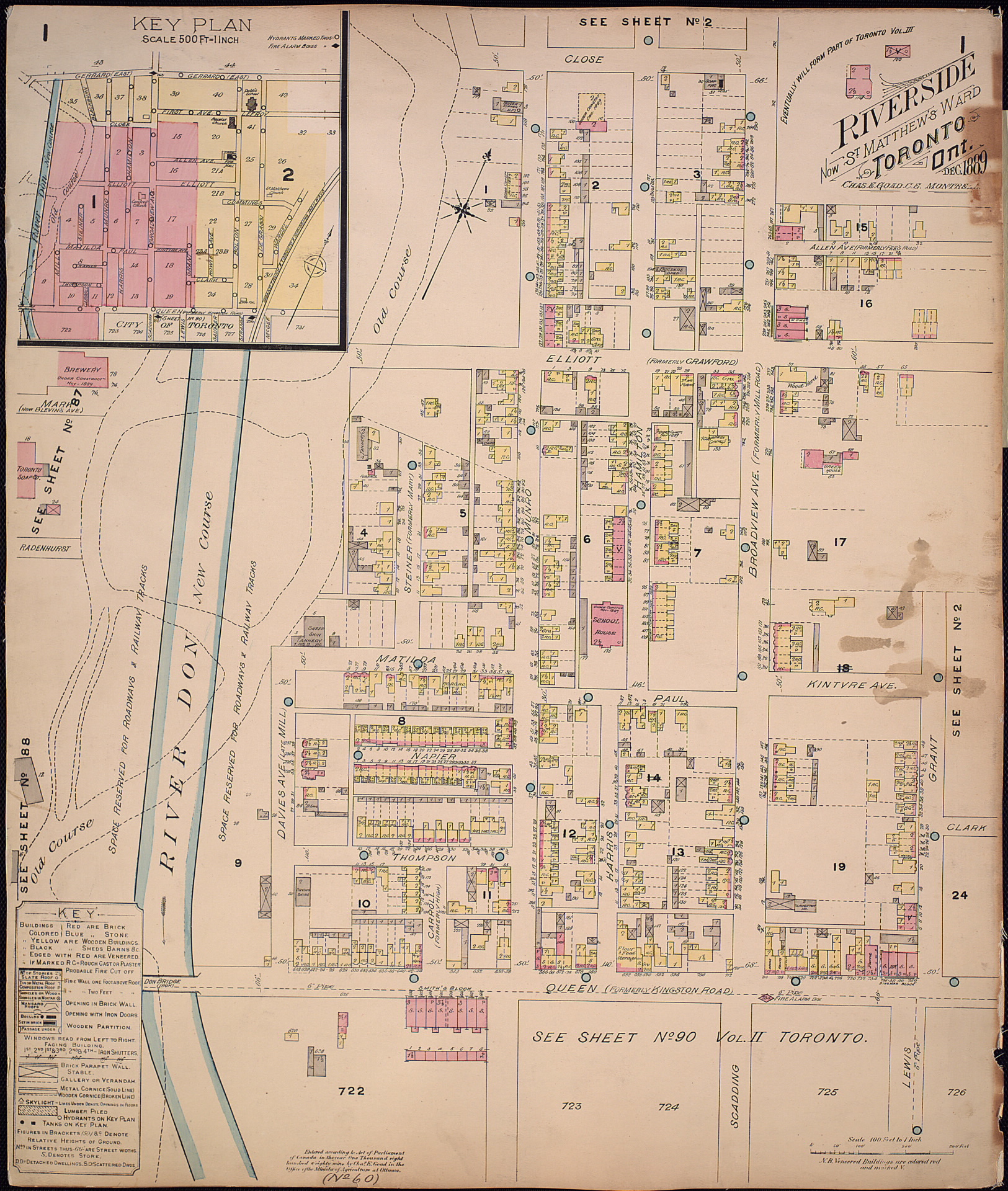
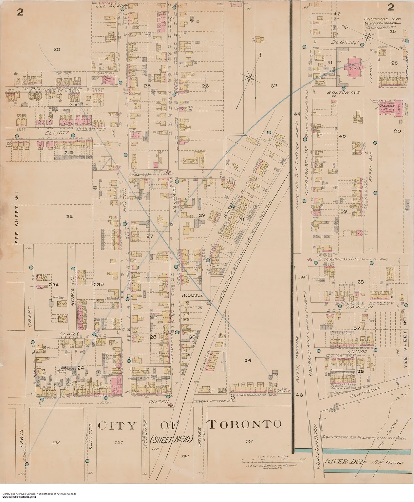
Fire insurance atlases and plans are detailed maps used to research the history of buildings and neighbourhoods. Atlases cover the city as a whole. Plans cover specific neighbourhoods and often have more detail than atlases.
You can view our holdings online (1858 to 1912) or in person (1858 to 1973).
Digitized fire insurance maps
This list includes maps from Toronto Public Library as well as other institutions.
Our atlases and volumes of plans are large PDFs with pages presented in their original order. Easier-to-navigate versions of with clickable pages are available from other sources, outlined in the "External sources" section under the "About these maps" section on this page.
Below is a map that shows approximate coverage of the volumes of plans. (Volumes 10 and 11 are not available digitally.)

Fire insurance maps available in person
Many of these maps—including those under copyright—can be viewed at Toronto Reference Library. Our finding aid lists what's available, with links to the catalogue records. Note: We are working to fix broken links in this finding aid.
About these maps
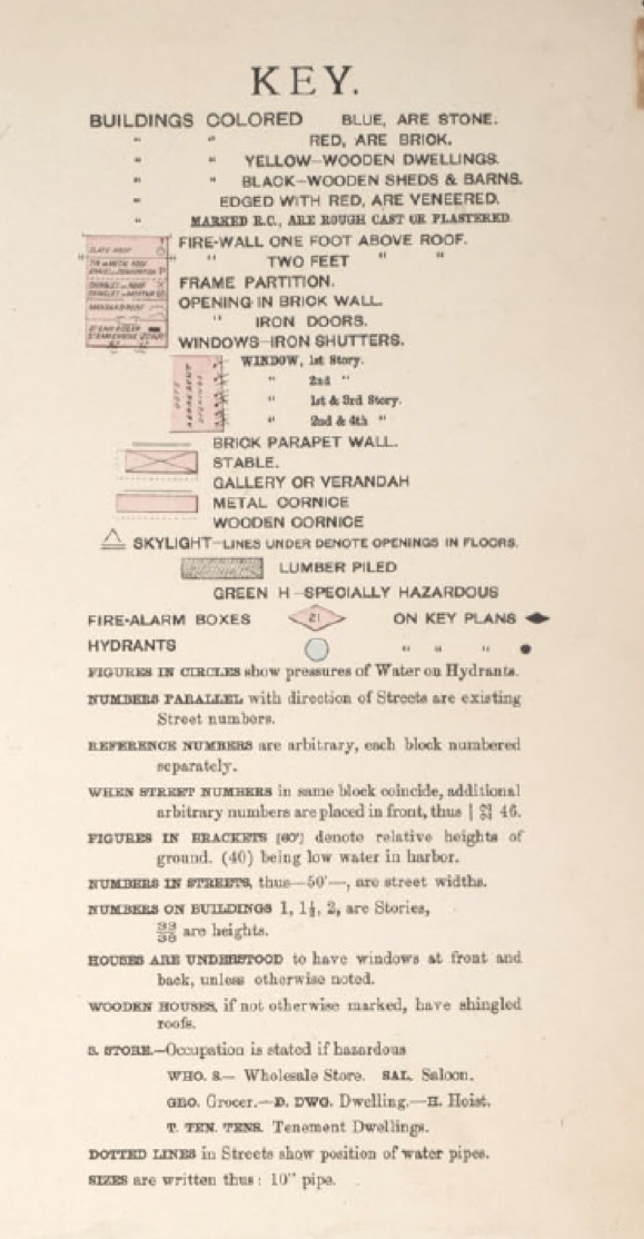
Fire insurance maps can be hard to understand at first glance. Learn about their history, current uses and tips on how to read them.